
Praha-X → Tours → The Royal Route → Route
The Royal Route: stop by stop
The whole route of the coronation processions from the Powder Tower to St Vitus Cathedral, stop by stop. You can watch the whole tour or open it at any stop.
Start the tour from the beginning
1438 — The Powder Tower and the King's Court
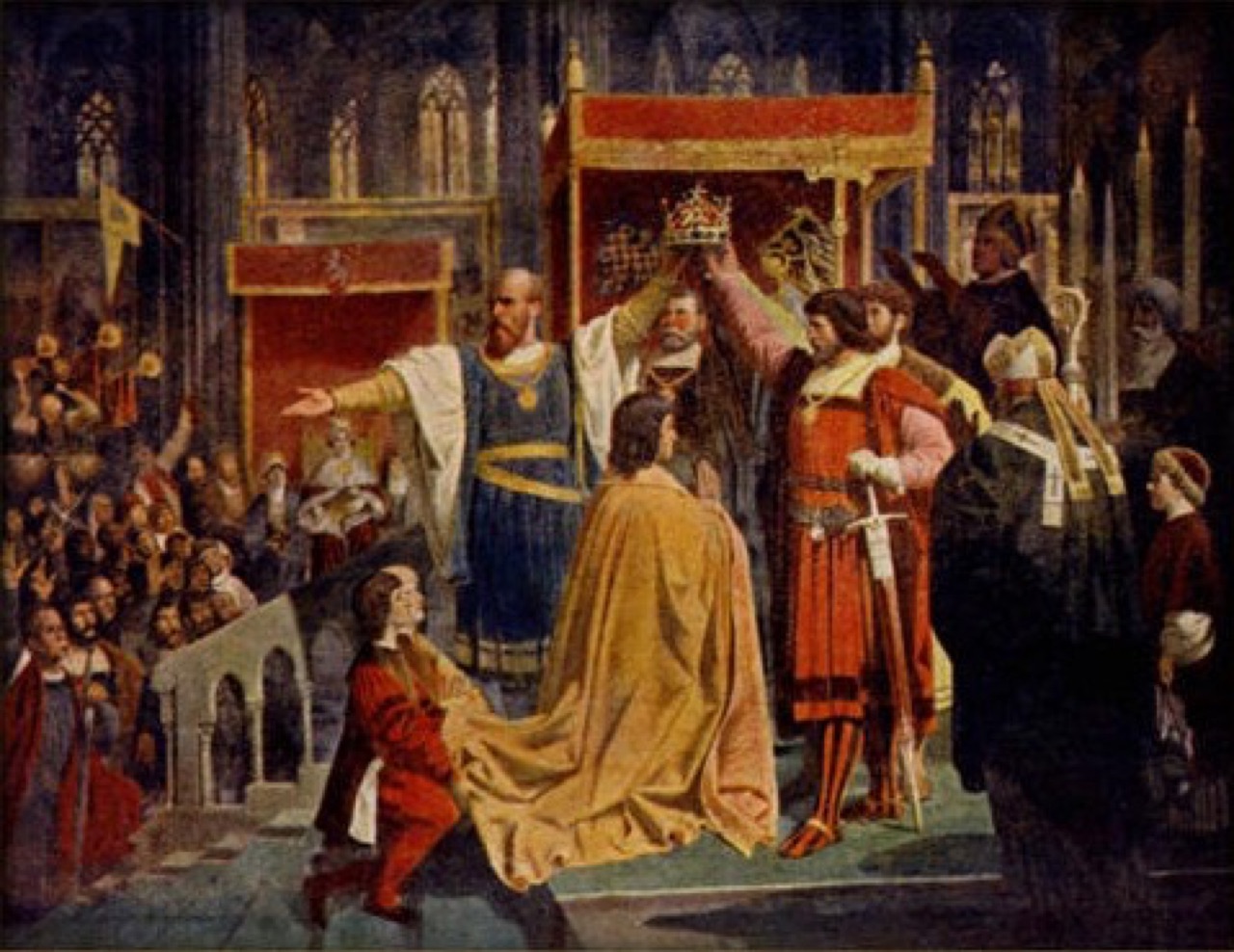
first coronation procession from the King's Court
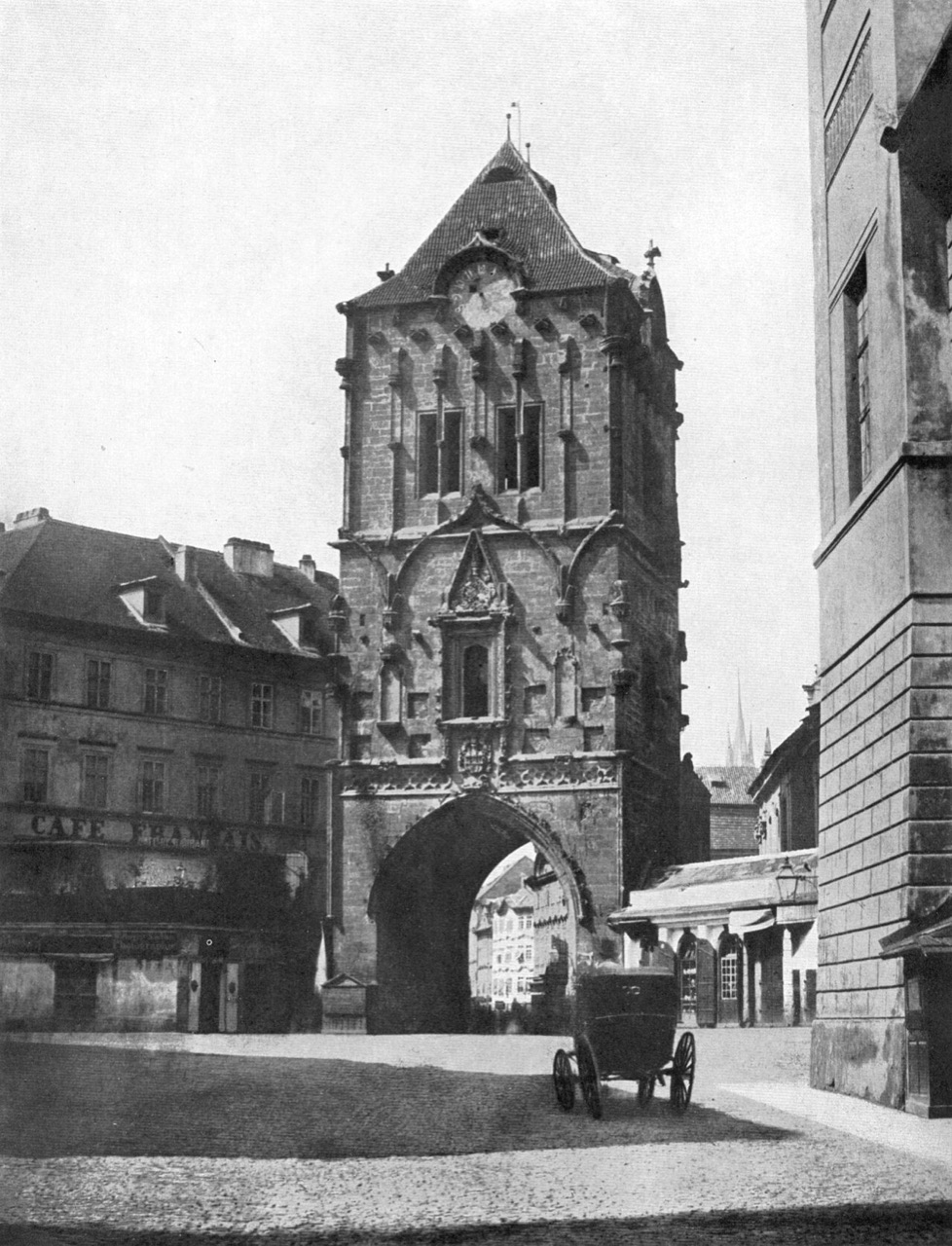
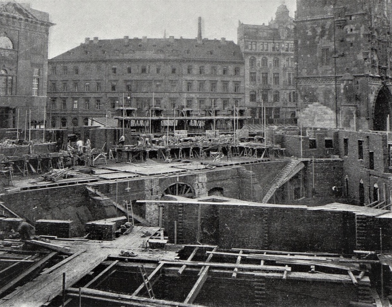
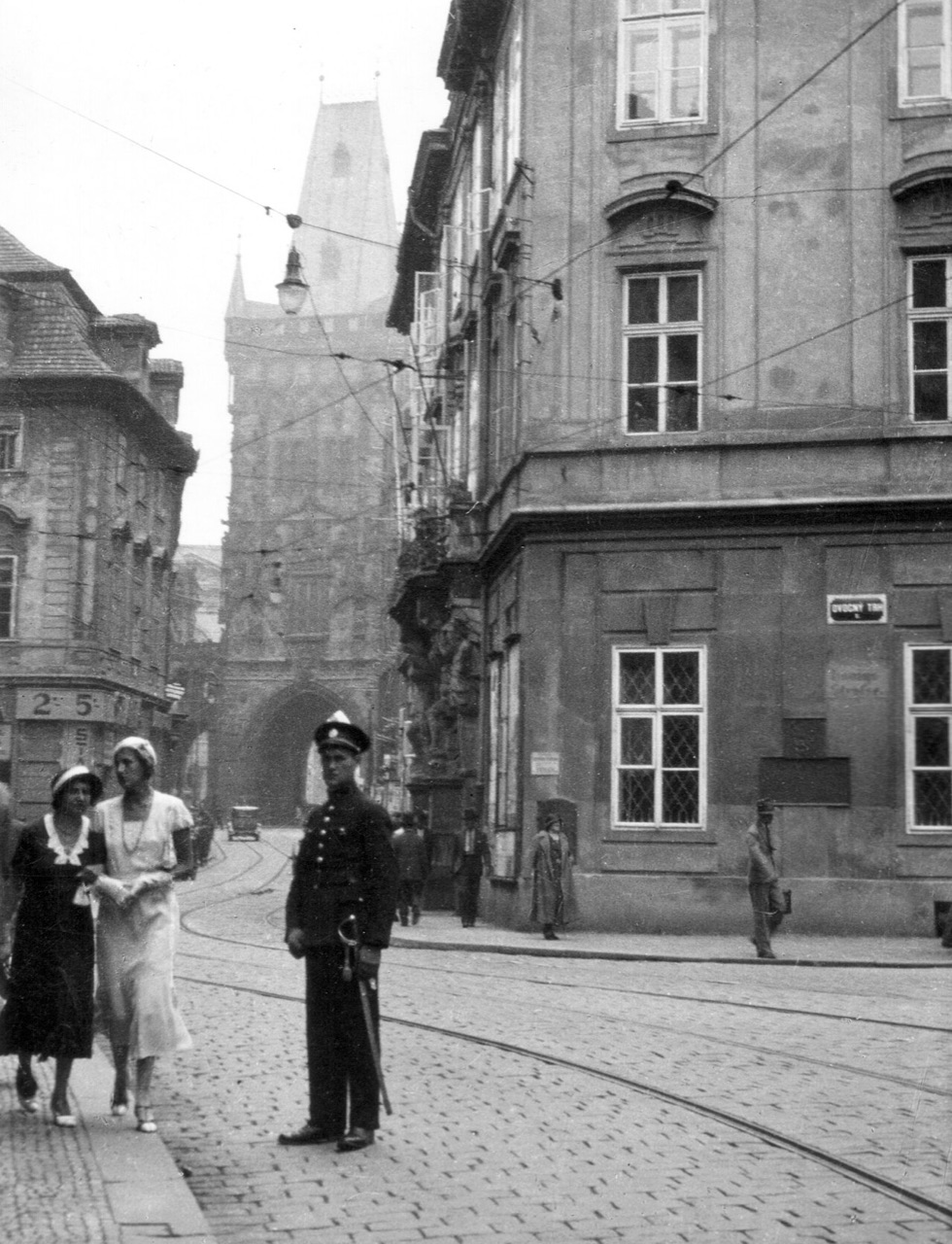
This is where the Royal Route began. Where the Municipal House stands now, the King's Court served as the town residence of Bohemian kings from 1383 to 1485, and in the 15th century coronation processions set out from it for the Castle, the first in June 1438 with Albert II of Habsburg. The Old Town began building the gate next to the court in 1475, but when the king moved back to the Castle in the 1480s it was left unfinished. It took its name in the 18th century, when gunpowder was stored inside. Its present roof and gallery were added by Josef Mocker at the end of the 19th century.
In the tour the camera comes out at 50.0872, 14.4278 and turns 14° while the story is told; the background is a drawn Art-Map 3D scene with sun and shadows.



More in the encyclopedia: Prašná brána · Králův dvůr
1912 — Celetná Street
the Cubist House of the Black Madonna, 1911–1912
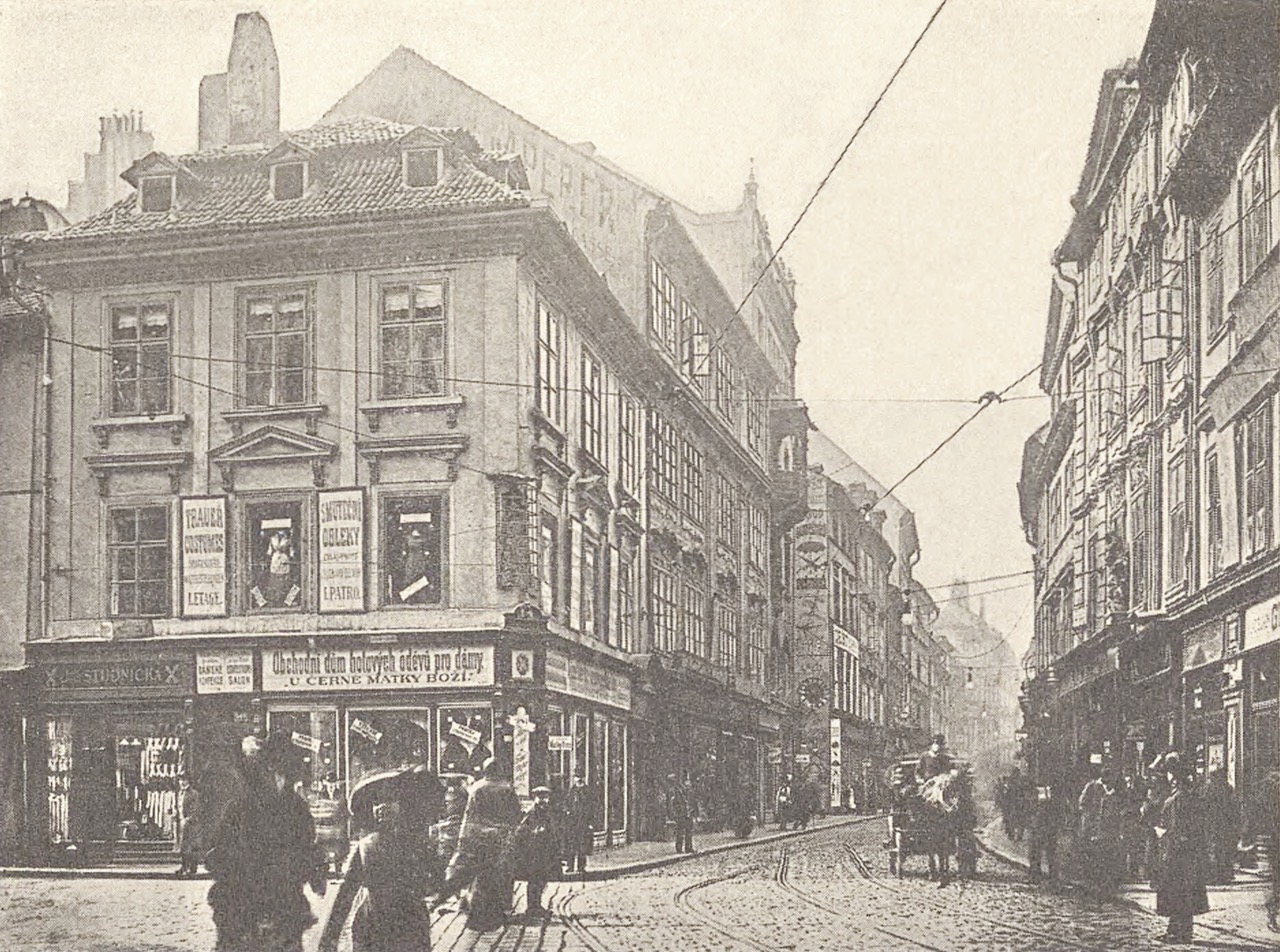
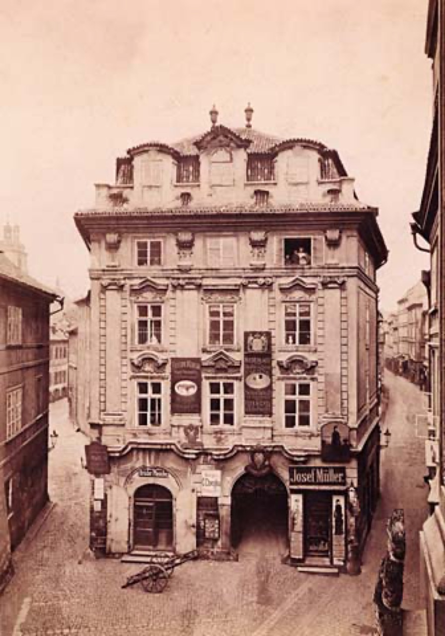
The street is named after calty, braided rolls once baked here by the caletníci. Along its roughly 400 metres you pass Romanesque cellars, Gothic houses and Baroque fronts; Franz Kafka lived at the House of the Three Kings from 1896 to 1907. On the corner of Ovocný trh Josef Gočár built the House of the Black Madonna in 1911–1912, the high point of Czech Cubism. It took its name from the Baroque house that stood here before it and still carries a Baroque Black Madonna on its corner.
In the tour the camera comes out at 50.0872, 14.4250 and turns 10° while the story is told; the background is a drawn Art-Map 3D scene with sun and shadows.



More in the encyclopedia: Celetná · Dům U Černé Matky Boží
1410 — Town Hall, clock and Týn
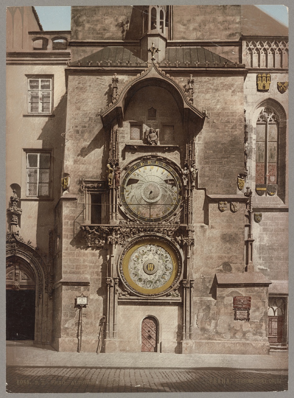
the clock first recorded on 9 October 1410
John of Luxembourg allowed the Old Town to set up a town hall in 1338, and the astronomical clock on its tower is first recorded in a deed of 9 October 1410; it was built by the clockmaker Mikuláš of Kadaň. The tale of Master Hanuš being blinded is only a legend: Hanuš adjusted the clock some 80 years later. George of Poděbrady was elected king in the town hall in 1458, and his statue and a golden chalice went up on the gable of Týn Church. Both were torn down in 1623. Twenty-seven crosses in the paving mark the execution of 21 June 1621.
In the tour the camera comes out at 50.0874, 14.4210 and turns 20° while the story is told; the background is a drawn Art-Map 3D scene with sun and shadows.

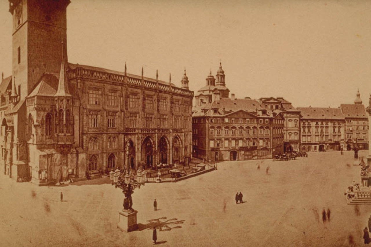

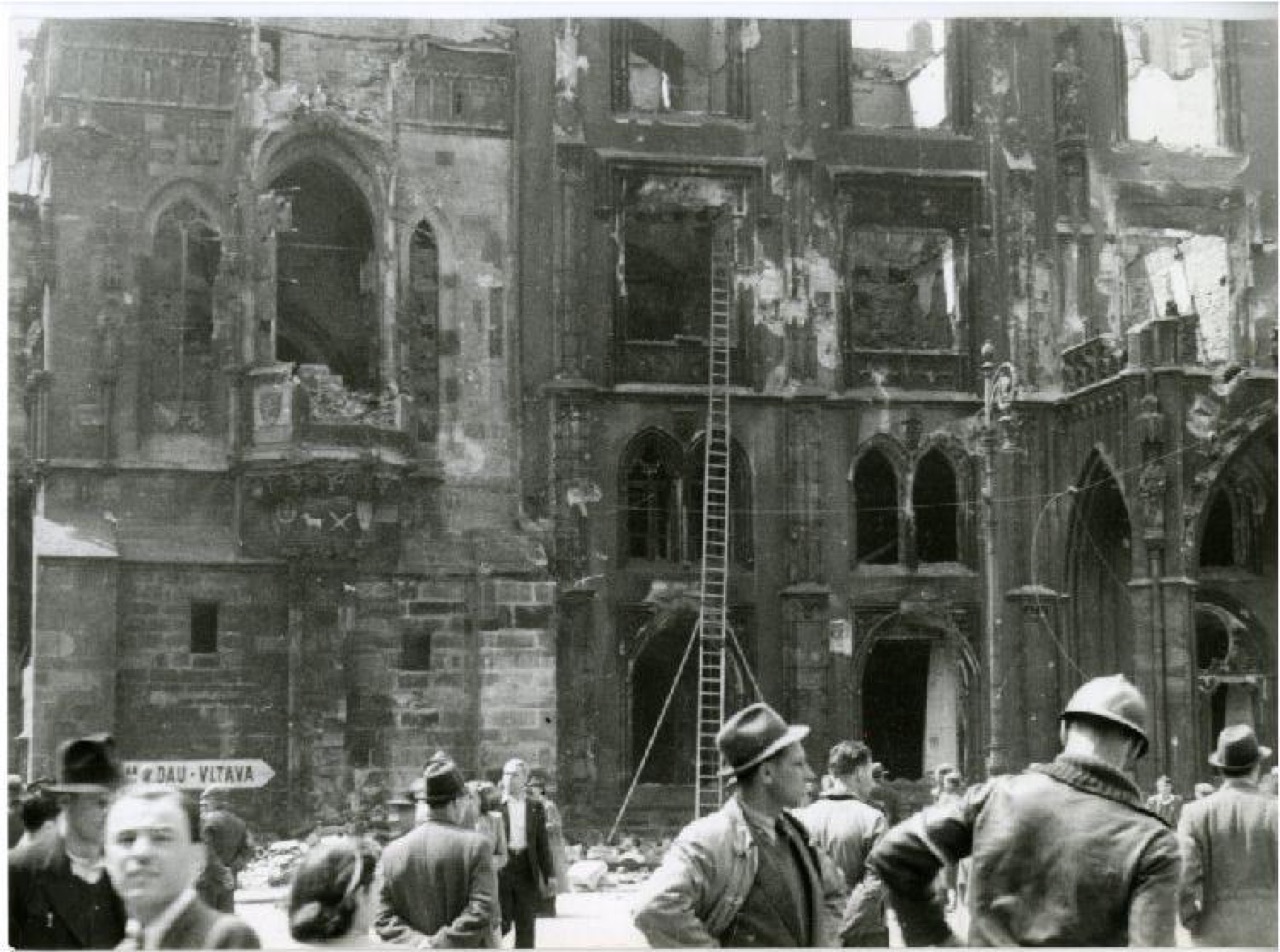

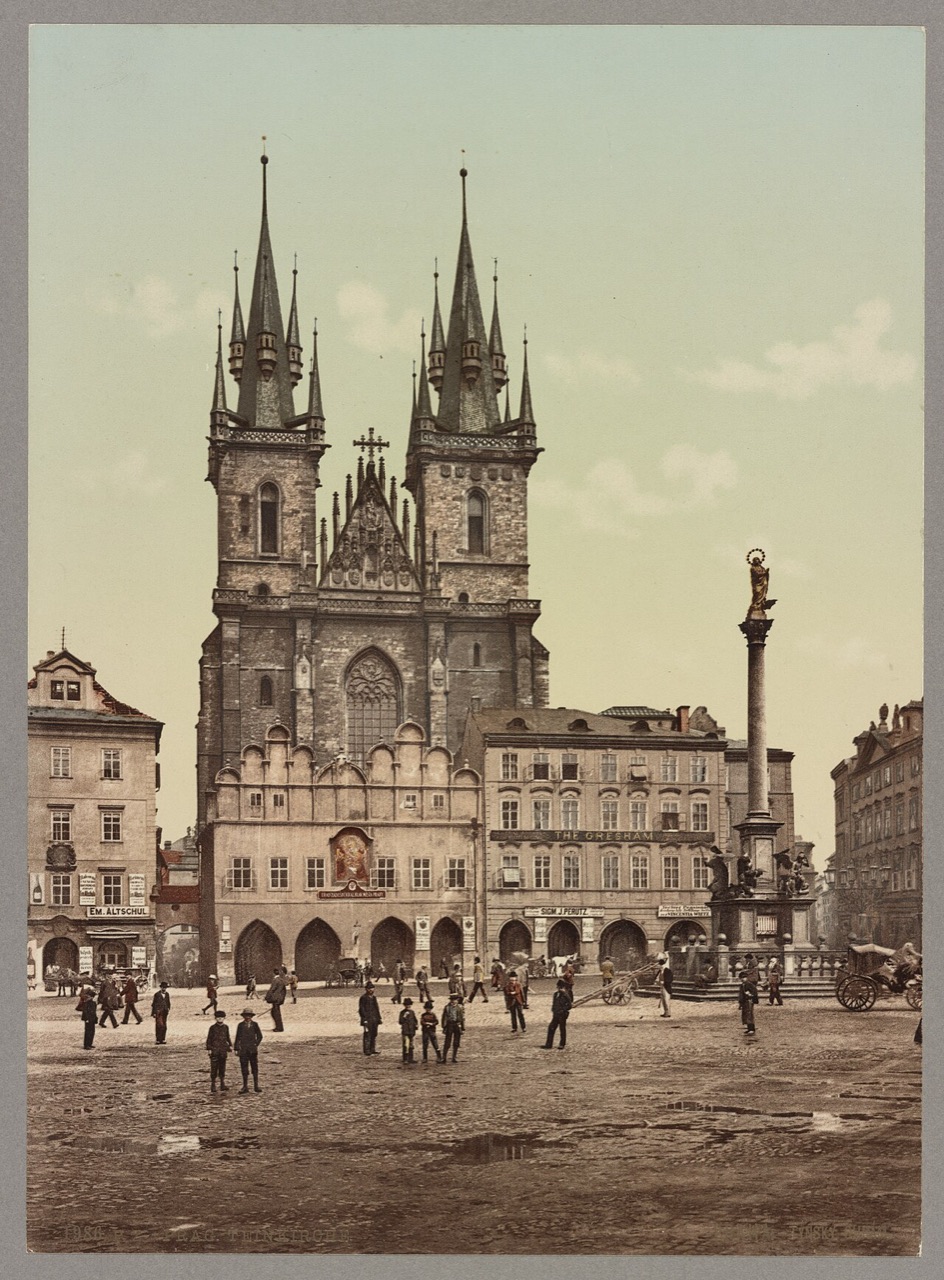

More in the encyclopedia: Staroměstské náměstí · Staroměstský orloj · Týnský chrám
1882 — Little Square and Karlova Street
Prague's first telephone exchange, 1882
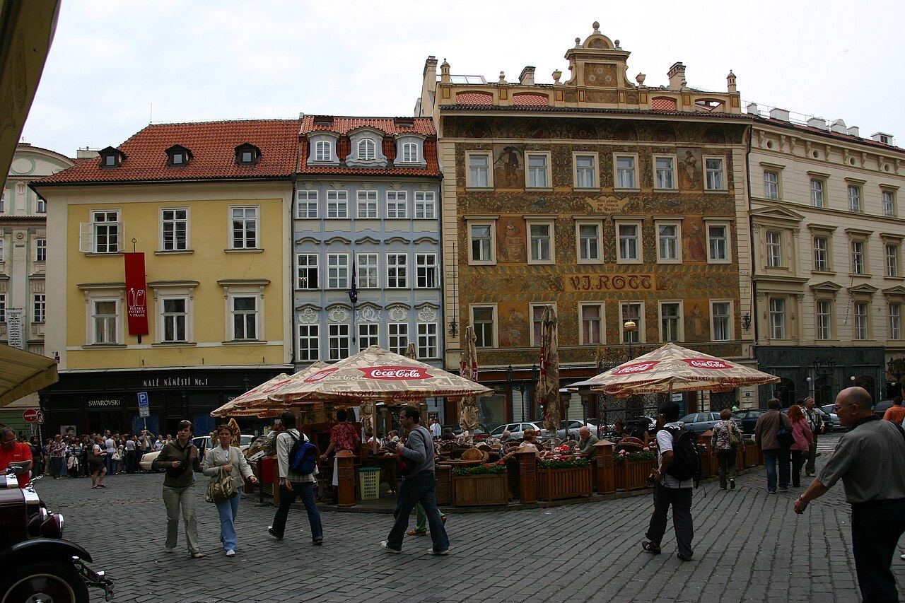
From Old Town Square the procession turned through the triangular Little Square. Prague's first telephone exchange opened in the Richter House here in 1882, and the Rott House opposite, painted after designs by Mikoláš Aleš, was known until the 1990s as a hardware store several floors high. From here the narrow, winding Karlova Street leads to Charles Bridge. The House at the Blue Pike, which squeezed it even narrower, was only pulled down in 1903.
In the tour the camera comes out at 50.0865, 14.4187 and turns 10° while the story is told; the background is a drawn Art-Map 3D scene with sun and shadows.
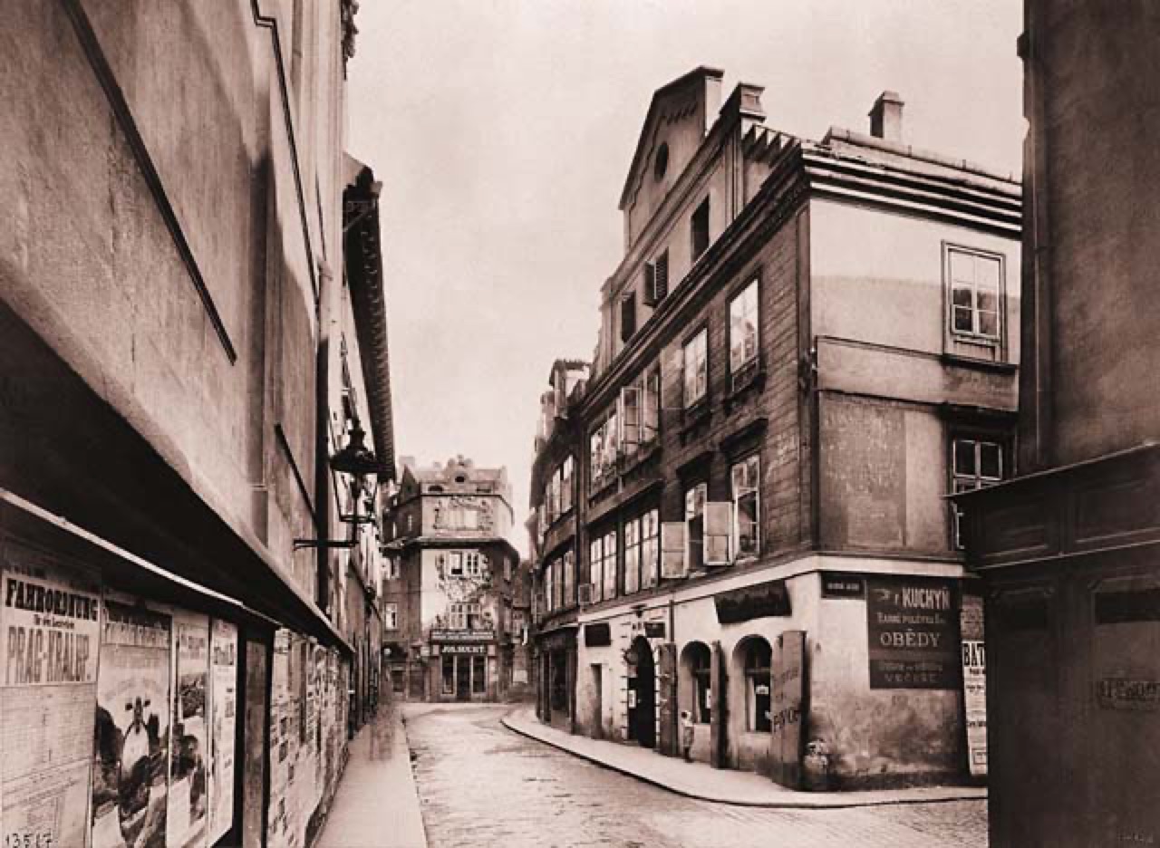


More in the encyclopedia: Malé náměstí · Karlova
1775 — The Clementinum
continuous weather records since 1775
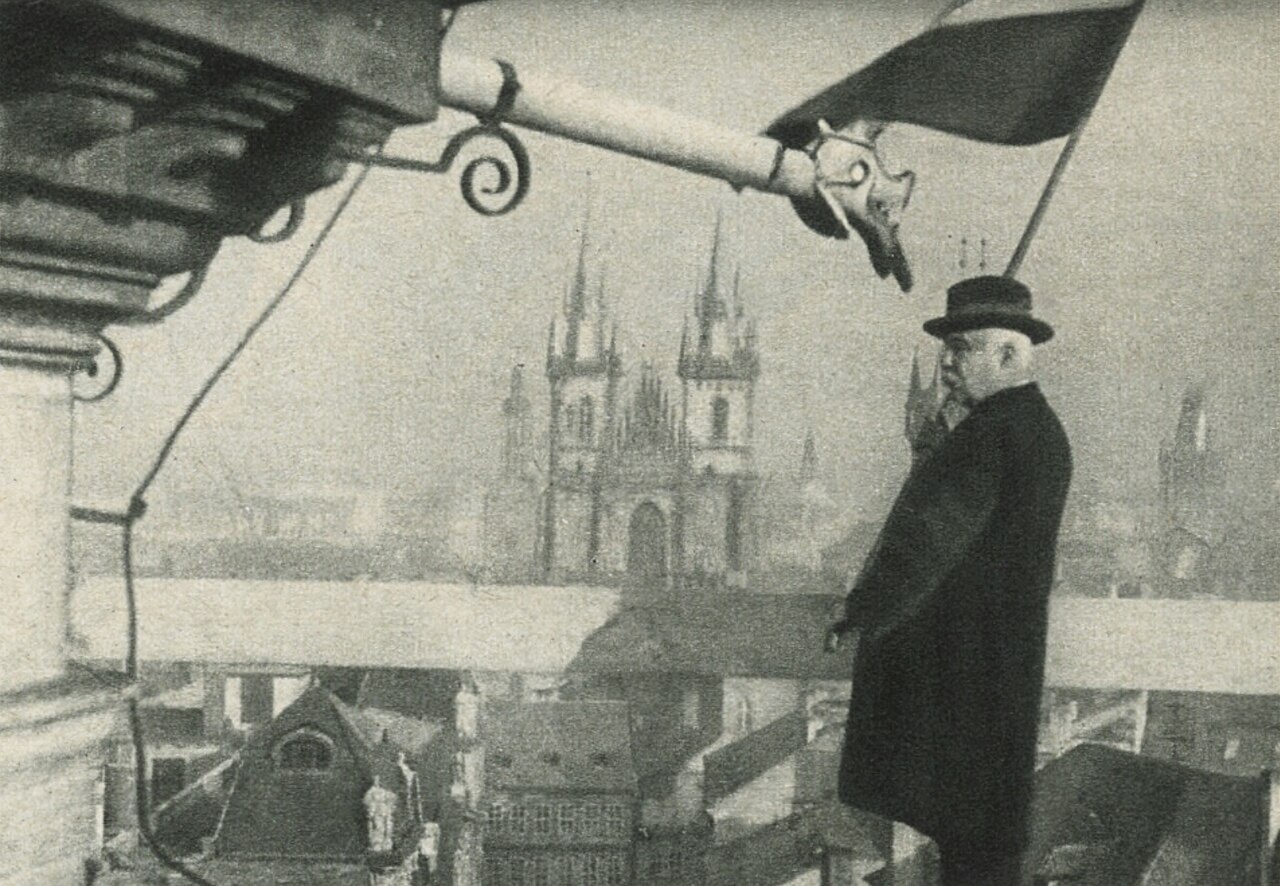
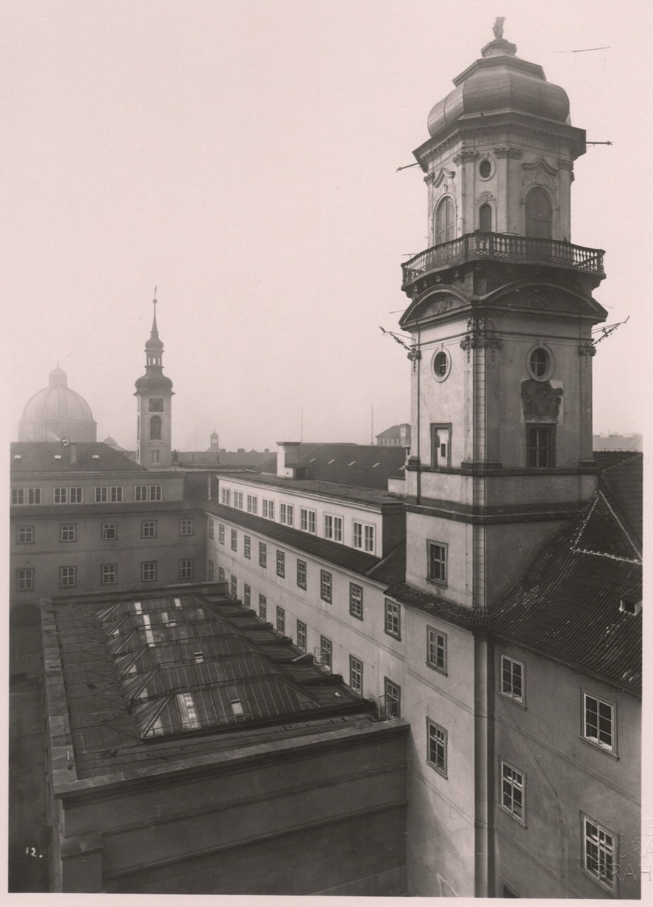
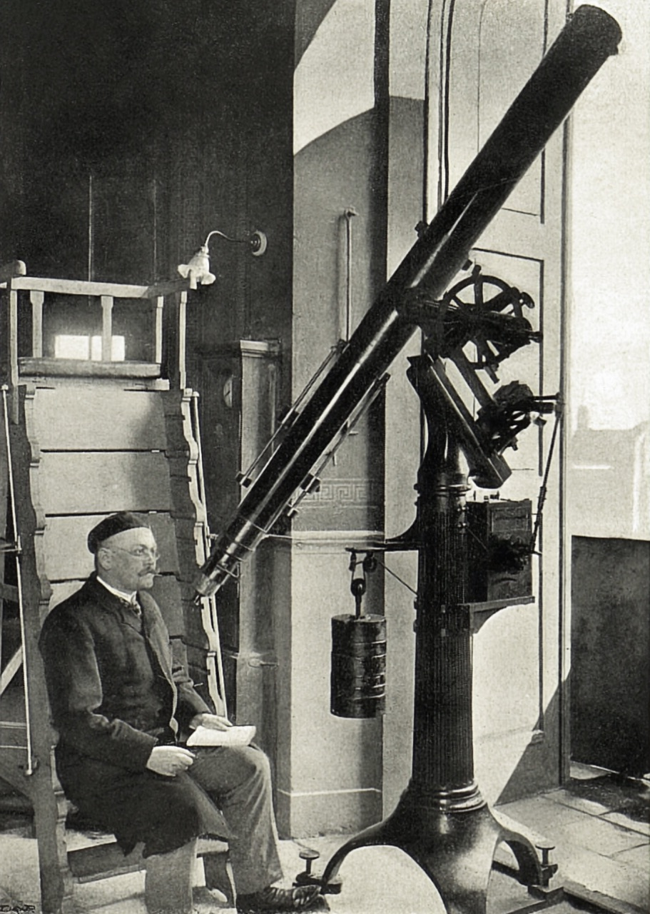
After Prague Castle, the Clementinum is the second largest complex of buildings in the city. The Jesuits moved into a former Dominican friary here in 1556 and in 1722 built the Astronomical Tower, topped by a statue of Atlas. The weather has been measured here without a break since 1775, the longest such record in Central Europe. From 1842 a flag was waved from the tower gallery at noon so Prague could set its clocks; the last time was 31 January 1928.
In the tour the camera comes out at 50.0866, 14.4161 and turns 16° while the story is told; the background is a drawn Art-Map 3D scene with sun and shadows.



More in the encyclopedia: Klementinum · Astronomická věž Klementina
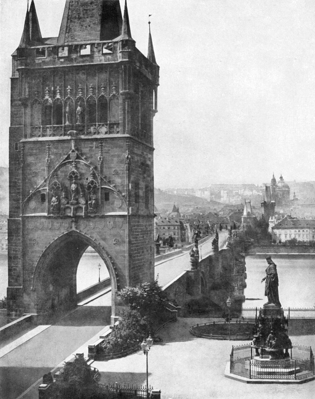
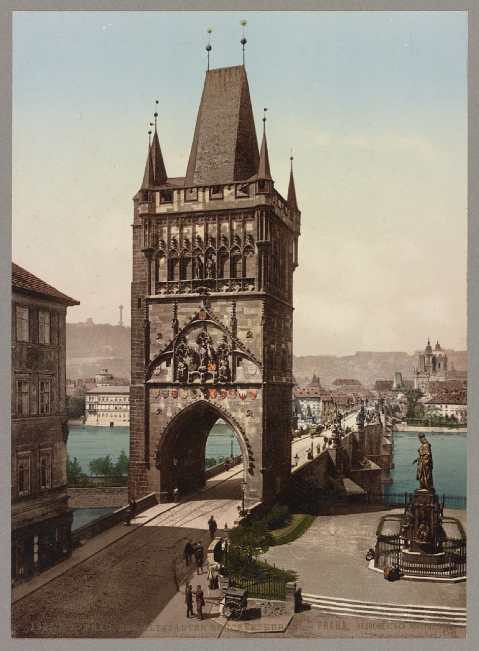
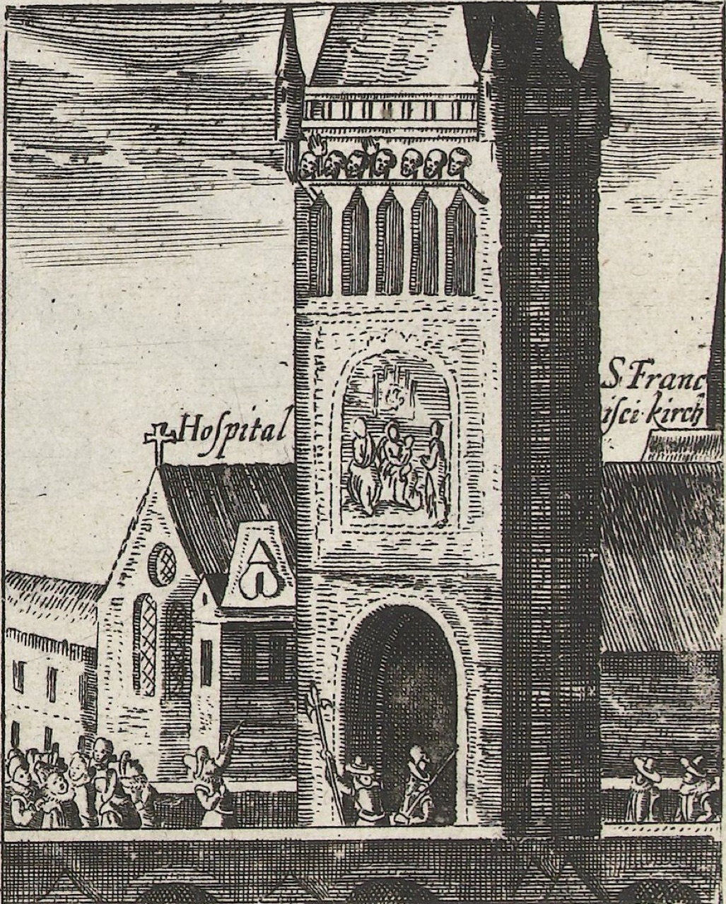
1621 — The Old Town Bridge Tower
heads of the executed hung here 1621–1631
The tower was built with the bridge by Peter Parler's workshop and finished at the end of the 14th century. Its Old Town side is a triumphal gate: Charles IV and his son Wenceslas IV sit enthroned on it, and a kingfisher in a twisted veil, Wenceslas's personal emblem, hides in the stone; there are five kingfishers on the tower, four of them facing the Old Town. After the execution of 1621 the heads of twelve of the executed were displayed on the gallery; the last were taken down only in 1631. In 1648 the Old Town held off the Swedes here.
In the tour the camera comes out at 50.0862, 14.4136 and turns 12° while the story is told; the background is a drawn Art-Map 3D scene with sun and shadows.



More in the encyclopedia: Staroměstská mostecká věž · Staroměstská exekuce
1357 — Charles Bridge
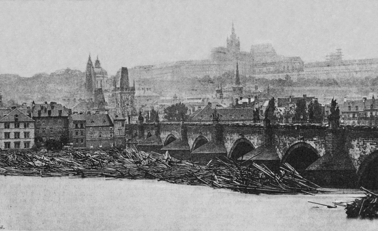
founded 1357, completed 1402
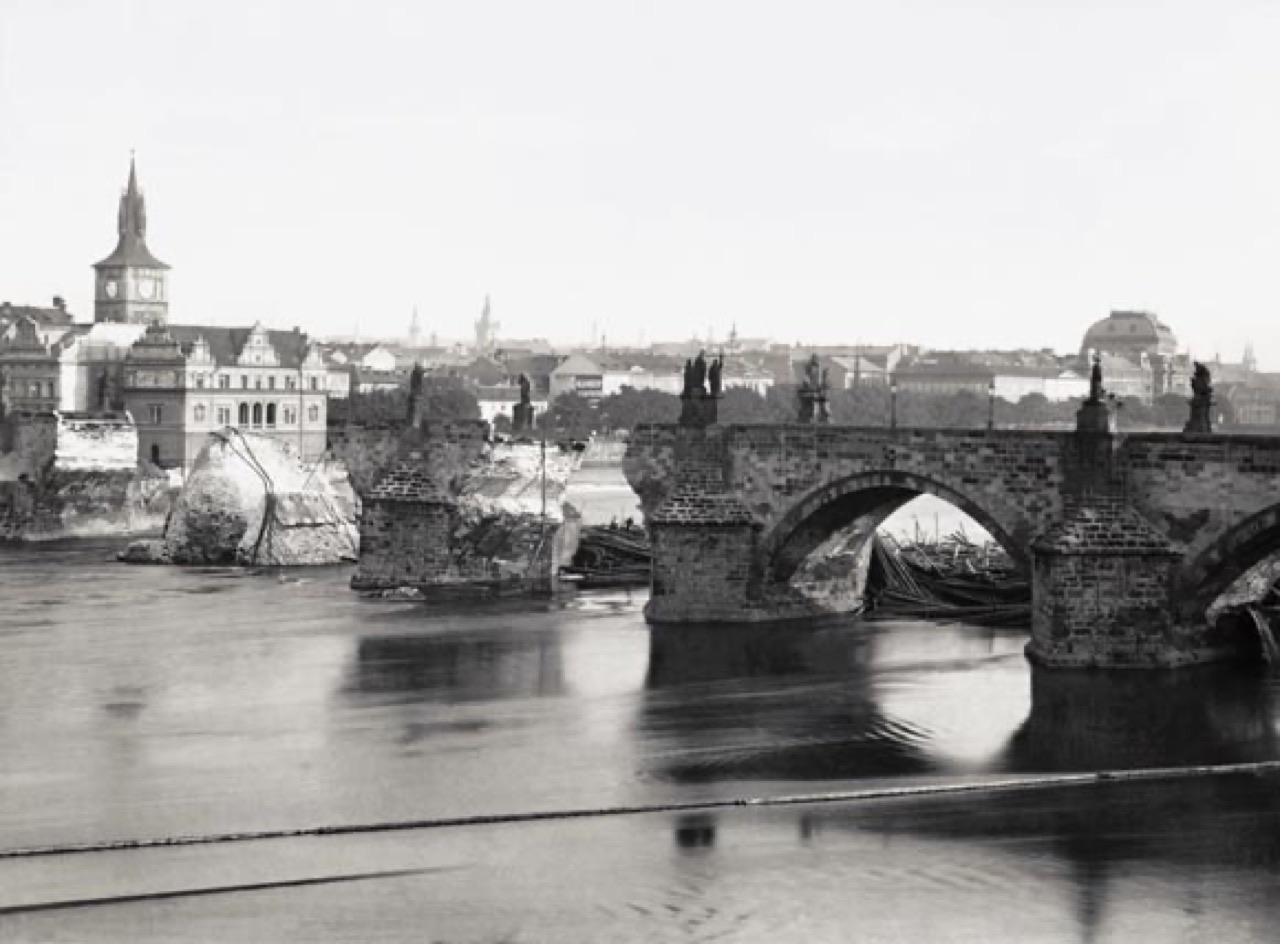
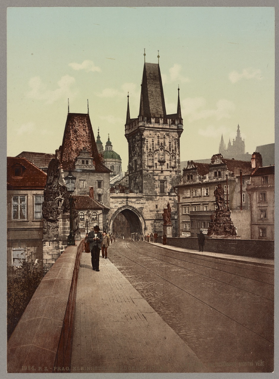
Charles IV had the stone bridge founded in 1357 to replace the Judith Bridge, carried away by ice in 1342; it was completed in 1402. The name Charles Bridge only caught on around 1870; until then it was simply the Stone Bridge. It is more than 515 metres long, and from the end of the 17th century 30 statues and groups were set on it. The lower of the two Lesser Town towers is older than Charles Bridge and dates back to the 12th-century Judith Bridge. In September 1890 a flood full of loose timber rafts brought down two arches.
In the tour the camera comes out at 50.0866, 14.4101 and turns 18° while the story is told; the background is a drawn Art-Map 3D scene with sun and shadows.



More in the encyclopedia: Karlův most · Malostranské mostecké věže
1752 — Lesser Town Square and St Nicholas
dome and bell tower finished around 1752
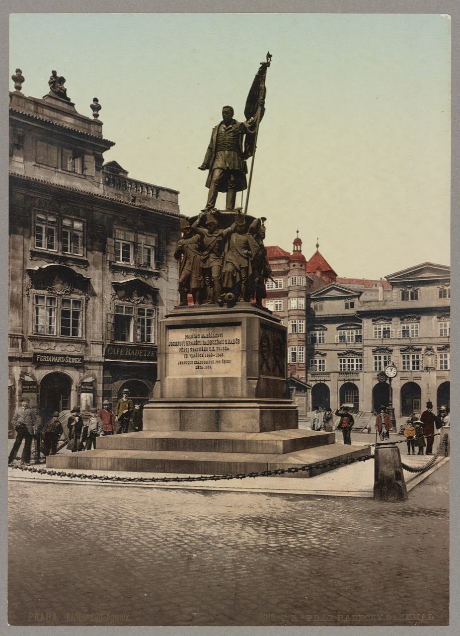
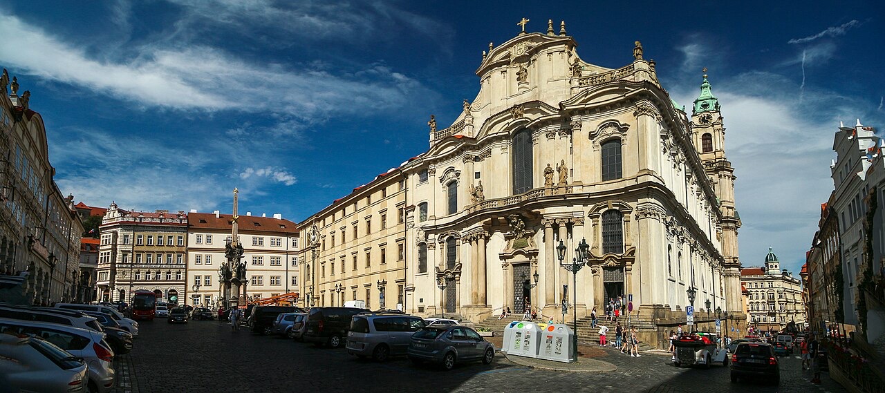
From 1283 a Gothic parish church of St Nicholas stood on the square. After the Battle of White Mountain it passed to the Jesuits, who pulled it down and from the early 18th century built a new church; from 1737 the work was led by Kilián Ignác Dientzenhofer, and the dome and bell tower were finished around 1752. The bell tower was won by the Lesser Town councillors and bears the town's arms over its door. Watchmen looked out for fires from it until 1891, and under communism the State Security used it to watch the nearby embassies.
In the tour the camera comes out at 50.0880, 14.4032 and turns 16° while the story is told; the background is a drawn Art-Map 3D scene with sun and shadows.


More in the encyclopedia: Malostranské náměstí · Kostel svatého Mikuláše (Malá Strana)
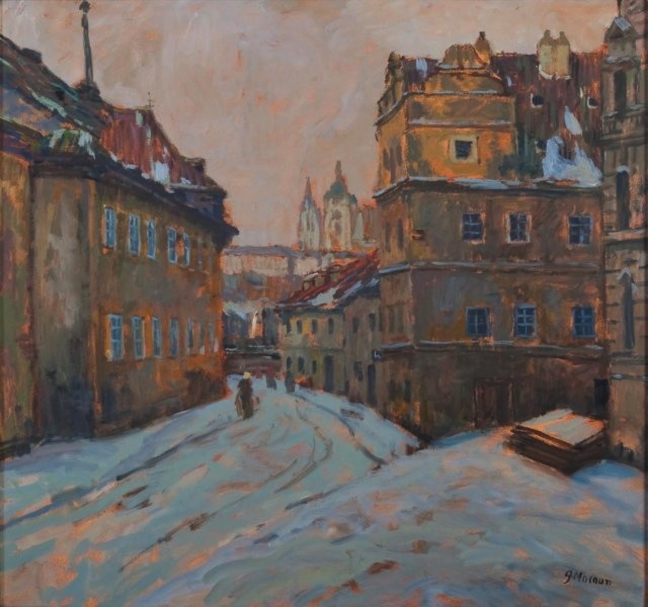
1895 — Nerudova Street
named after Neruda since 1895
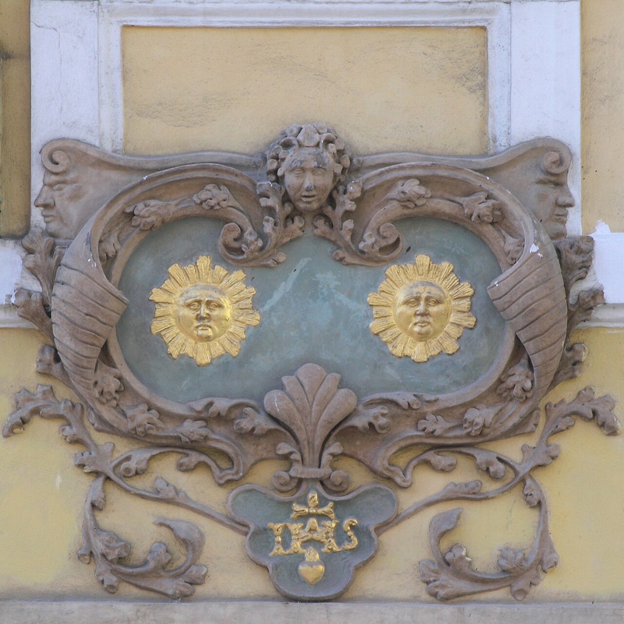
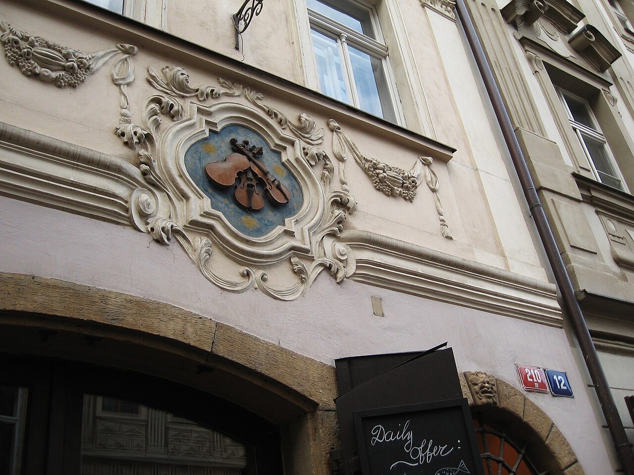
Nerudova has been the main street of the Lesser Town since the town was founded in the 13th century. To help carts up the slope, wooden beams were laid into the paving, so for a long time it was called Rafter Street. Houses here are still known by their signs: two suns, three little fiddles, a golden horseshoe. Jan Neruda lived at the House of the Two Suns from 1845 to 1857, and in 1895 the street took his name. At the top the procession turned into Ke Hradu, a street laid out only in the 17th century.
In the tour the camera comes out at 50.0885, 14.3990 and turns 10° while the story is told; the background is a drawn Art-Map 3D scene with sun and shadows.



More in the encyclopedia: Nerudova · Jan Neruda
1598 — Hradčany Square
Hradčany a royal town from 1598
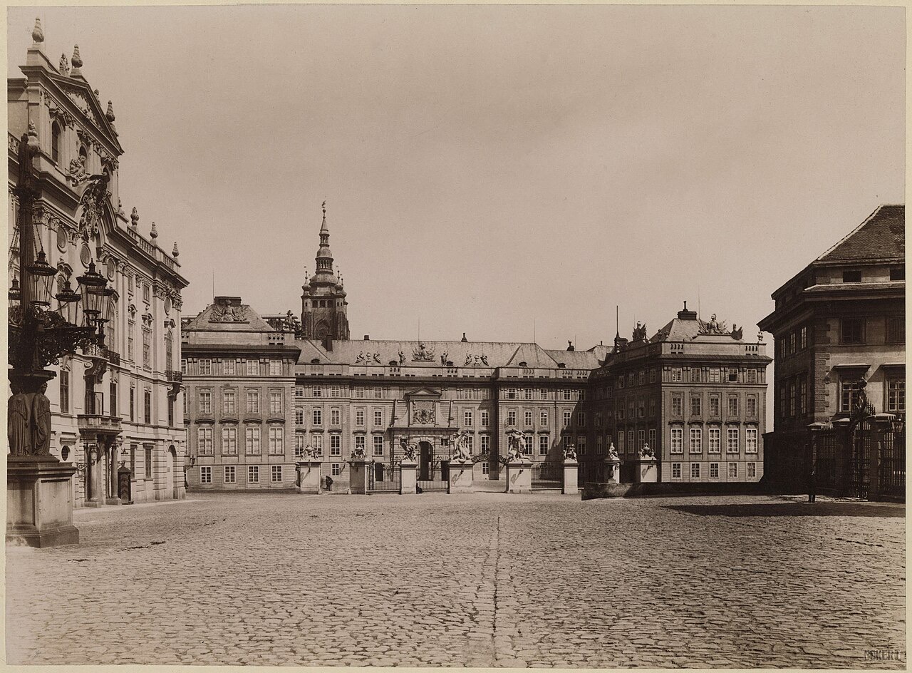
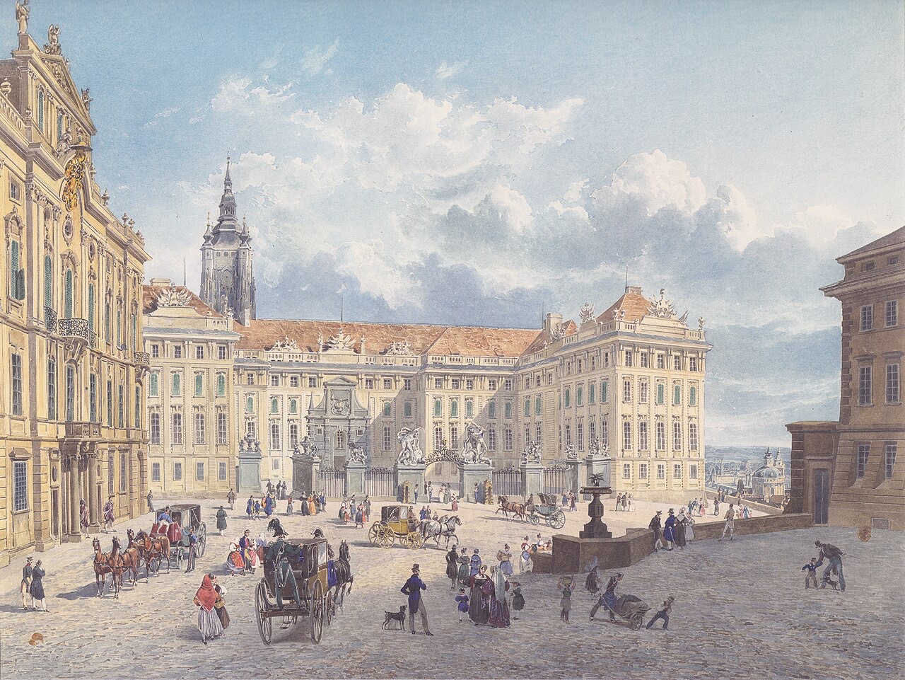
Hradčany Square was the main square of the smallest of Prague's towns; Rudolf II made Hradčany a royal town in 1598. After the great fire of 1541 the nobility built palaces here, and the archbishops of Prague have resided here since 1561. A moat once ran in front of the Castle gate. It was filled in only during the rebuilding of the Castle under Maria Theresa, which created today's courtyard of honour.
In the tour the camera comes out at 50.0895, 14.3977 and turns 14° while the story is told; the background is a drawn Art-Map 3D scene with sun and shadows.


More in the encyclopedia: Hradčanské náměstí
1836 — Prague Castle and St Vitus Cathedral
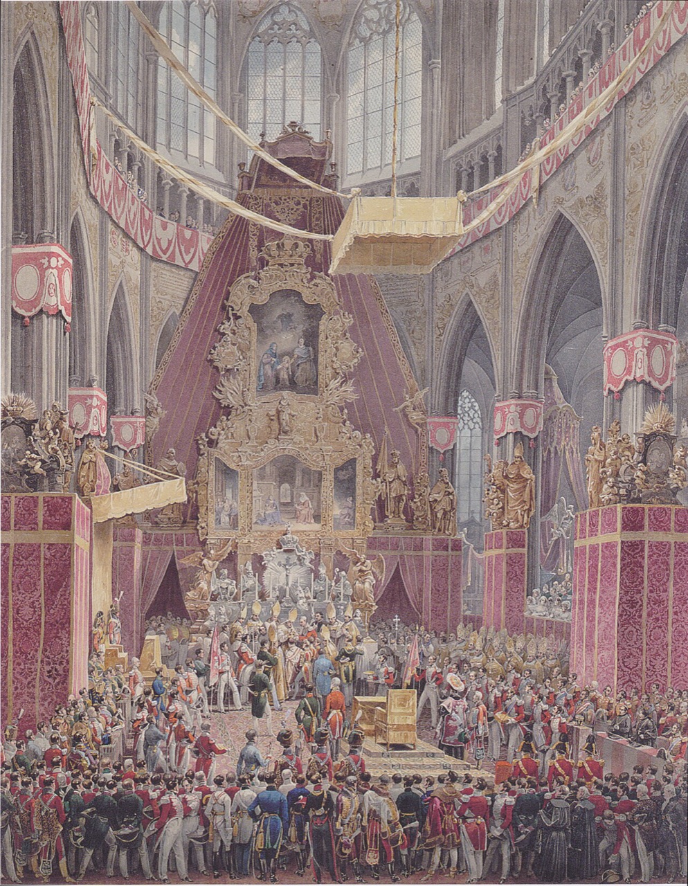
the last coronation, 7 September 1836
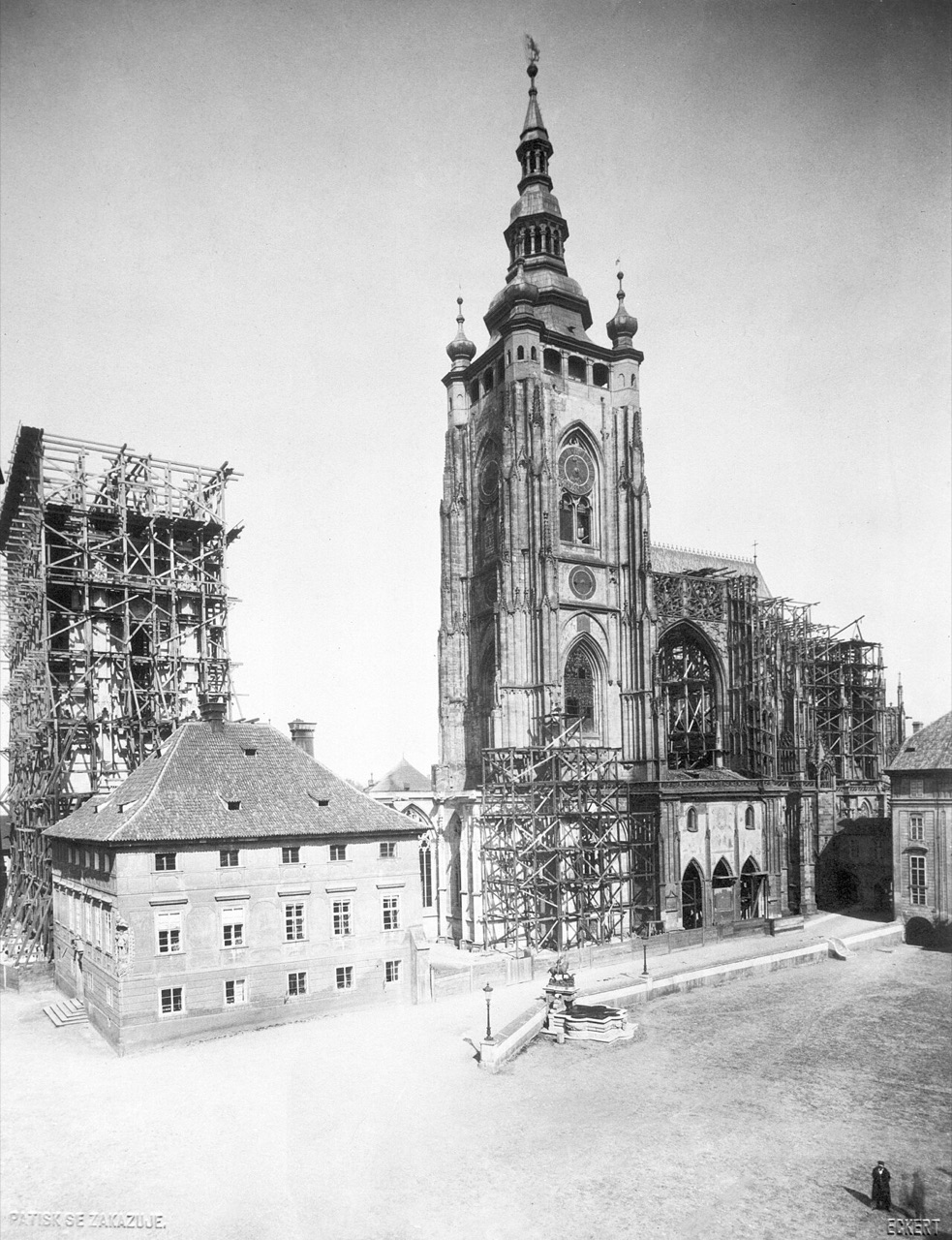
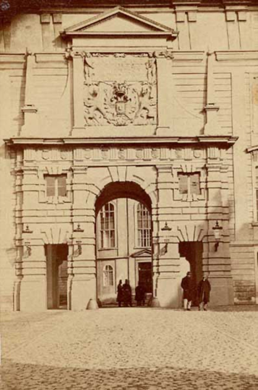
The route ended at St Vitus Cathedral; today you reach it through the Matthias Gate of 1614, the oldest secular Baroque building in Prague. John of Luxembourg laid the cathedral's foundation stone on 21 November 1344, and it was completed only in 1929. From the St Wenceslas Chapel a door leads to the Crown Chamber, home of the St Wenceslas Crown that Charles IV had made for his coronation; the door has seven locks and seven people hold the keys. The last king crowned here was Ferdinand V, on 7 September 1836.
In the tour the camera comes out at 50.0909, 14.4006 and turns 36° while the story is told; the background is a drawn Art-Map 3D scene with sun and shadows.



More in the encyclopedia: Pražský hrad · Katedrála svatého Víta · České korunovační klenoty
The route is put together from articles of the Praha-X encyclopedia. Other routes are on the tours page.
Art-Map Praha-X 3D scenes: building geometry and heights © OpenStreetMap contributors (ODbL), sunlight and shadows follow the real position of the sun over Prague, rendered with three.js.